


THE CO-OPERATION OF REGIONAL AIR NAVIGATION
SERVICES PROVIDERS
By Dmytro Babeychuk (UkSATSE, Ukraine)
 |
A meeting of the representatives of Azerbaijan Air Navigation Services "AZERAERONAVIGATSIA" (Azerbaijan), State Enterprise "KAZAERONAVIGATSIA" (Kazakhstan), State Enterprise "SAKAERONAVIGATSIA" (Georgia), Moldavian Air Traffic Services Authority "MoldATSA" (Moldova) and Ukrainian State Air Traffic Service Enterprise (further UkSATSE) was held on February 4 2002 in Maastricht, the Netherlands. The meeting was focused on the trends of world civil aviation development, the Parties' approach to the planning of their national air navigation systems development and Global Navigation Satellite System (GNSS) implementation. |
The representatives of the above-mentioned ANS Providers agreed to elaborate and sign an agreement on co-operation. It was also agreed to apply to U.S. Trade and Development Agency (USTDA) for a grant to conduct feasibility studies of CNS/ATM Planning Project. In order to facilitate the attainment of the aims set forth, UkSATSE was nominated by the ANS Providers to serve as a co-ordinator of the Feasibility Studies Project in tight co-operation with the focal points appointed by the other ANS Providers.
During the International Conference "Paving the way to the smooth Europe-Central Asia interface", which was held on June 19-21 2002 in Baku (Azerbaijan), the ANS Providers of Azerbaijan, Kazakhstan, Georgia, Moldova and Ukraine signed the Agreement on Co-operation, hereinafter referred to as the Agreement, and an Air Navigation Services Providers Regional Co-operation Group (further Regional Group) was formed. The primary goals of this Agreement are:
- development of agreed strategy for CNS/ATM systems implementation;
- co-operation in the field of ASM, ATS route network development and AIS;
- co-operation in the field of GNSS implementation;
- development and harmonisation of ATM in line with policies of the International Civil Aviation Organisation (ICAO) and the European Civil Aviation Conference (ECAC), as well as Programmes of the European Organisation for the safety of Air Navigation (EUROCONTROL).
This event became a milestone in development of long-term co-operation between the ANS Providers. The Agreement has set down the directions and tools of mutual co-operation particularly in the field of CNS/ATM as well as further development of the transport corridor Europe-Caucasus-Asia. The Parties to the Agreement have agreed to work out common regional approaches to develop ANS market within their part of the Black Sea and Caspian Region.
It should be noted that regional approach to CNS/ATM development within the framework of the Agreement and establishment of Regional Group were completely supported by such authoritative international aviation organisations as ICAO, EUROCONTROL, ECAC and the International Air Traffic Association (IATA). "The Agreement on Co-operation between 5 States could provide an interesting example for the other parts of the Region and further evolve strategic perspectives related to the CNS/ATM system implementation" (Christian Eigl, ICAO Regional Director, Europe and North Atlantic).
The first meeting of the ANS Providers' representatives, which was held on September 10-13 2002 in Kyiv, Ukraine, became the next landmark in development of their co-operation. At this meeting the representatives of ANS Providers of Azerbaijan, Kazakhstan, Georgia, Moldova and Ukraine unanimously approved accession of Armenian ANS Provider "ARMAERONAVIGATSIA" to the Agreement. The participants of the meeting discussed issues of further development of regional co-operation and resolved to establish the Regional Air Navigation Services Development Association (RADA) on the basis of Regional Group. As a result of discussions it was agreed to form the Council and the Organising Committee of the Association. The Organising Committee was entrusted to prepare the Draft Charter of RADA and make suggestions on creation of joint web site. The ANS Providers' representatives also discussed the ways of the Feasibility Studies Project implementation with USTDA and approved Terms of Reference of Regional CNS/ATM Transition Plan Study.
Furthermore, it was agreed with EUROCONTROL to organise Workshops on Organisational Excellence and ATM safety for RADA members' administrative personnel and representatives of other organisations on April 23 2003 in Kyiv (Ukraine).
Information about RADA has been submitted to many international aviation organisations including ICAO, EUROCONTROL, ECAC, IATA, the Air Traffic Control Association (ATCA) and the Civil Air Navigation Services Organisation (CANSO). These organisations have completely supported the ANS Providers' initiative to establish RADA.
At the second meeting of the Council of the Association, which was held on February 17 2003 in Maastricht, the Netherlands, the ANS Providers' representatives approved the Statute of the Association and made the following decisions regarding further co-operation:
- to approve representation on behalf of RADA in COG EANPG (ICAO) in rotation.
- to elaborate draft agreements on co-operation with alliances of airlines;
- to establish the following working groups: AIS/AIM Working Group, Personnel Training Working Group, English Training Working Group and Joint Insurance Working Group;
- to develop further co-operation within the framework of the Agreement on Co-operation between the Air Navigation Services Providers.
The next meeting of RADA Council is to be held on April 23-24 2003 in Kyiv, Ukraine.
The meetings of RADA, EURUCONTROL and CANSO representatives were also held on February 20 2003. The perspectives of co-operation between RADA and these organisations were discussed at the meetings.
RADA members (February 2003):
1. Armenian Air Navigation Services "ARMAERONAVIGATSIA" Director - Eduard Mousoyan.
2. Azerbaijan Air Navigation Services "AZERAERONAVIGATSIA " Director - Valeriy Soultanov.
3. State Enterprise "KAZAERONAVIGATSIA" Director General - Sergey Kulnazarov.
4. Moldavian Air Traffic Services Authority "MoldATSA", Director General - Valerian Vartic.
5. State Enterprise "SAKAERONAVIGATSIA", Director - Aleksander Silagadze.
6. Ukrainian State Air Traffic Service Enterprise, Director General - Yuriy Cherednichenko.

NEWS FROM EUROPE
By Paul Bosman (Eurocontrol, Belgium)
|
AIS Golden Jubilee celebration Did you know that ?- On 15th May 1953 (so 50 years ago!) the first set of AIS SARPs was adopted by the ICAO Council as Annex 15 to the Council. - A number of (to our knowledge mainly Eastern-European) States celebrate since a number of years for this reason 15th May as an AIS Day - 15th May is this year an AIRAC Effective date So join us and celebrate on 15th May the AIS Golden Jubilee ! Raise the profile of AIS (and at the same time AIRAC) with your Data Originators, Staff and Users. Invite them for lunch and/or drinks, Add a little 'What is AIS' leaflet to your AIP Amendment or simply organise a party with your colleagues ! |
||
|
ÀIS ÀGÎRÀ http://www.eurocontrol.int/aisagora | ||
| ||
ÀIRÀC | ||
| ||
Ýëåêòðîííûé ÀÈÏ http://www.eurocontrol.int/ais - Electronic AIP | ||
| ||
SkyView 2 http://www.eurocontrol.int/ais | ||
| ||
| Skyview 2 is delivered with a set of European data, but users can import (amongst others) ArcView SHAPE (.shp) and GeoTIFF files. A brand new feature is the exporting of SVG files so now SVG-chart production is at easy-hand to everybody. Both software and data delivery is web based and free of charge. (EUROCONTROL preserves the right to restrict access.) See http://www.eurocontrol.int/ais - SkyView 2 for full information. | ||
|

ELECTRONIC AERONAUTICAL INFORMATION:
BELGOCONTROL AMONG THE LEADERS!
Based on materials send by Alexandre Petrovsky (Eurocontrol, Belgium)
Between 25 and 27 March, EUROCONTROL and IATA organised a major symposium in Toulouse, the heart of the European aeronautical and aerospace industry, entitled "One AIM for Europe". Belgocontrol was prominently present.
A Varied Platform
The symposium brought together many representatives of various aeronautical sectors from more than 50 countries throughout the world. The participants came both from military and civil aviation and from the most highly-reputed aeronautical organisations.The aim of the meeting was to mark out possible ways of achieving an integrated world-wide solution for aeronautical information. AIM (Aeronautical Information Management) serves to create a bridge between the various sources of information such as AIS (the Aeronautical Information Service), MET (Meteorological Services for Air Navigation), ATFM (Air Traffic Flow Management) etc. Improving the quality and integrity of information will ultimately also lead to greater air traffic safety.
Belgocontrol In The Spotlight
At the symposium, Regine Leurquin (A/I/S) and Stephane Thill (O/ATS/P) delivered, in conjunction with EUROCONTROL, an extremely well-received presentation on the prototype eAIP (electronic AIP - see below). This was also a great opportunity to promote Belgocontrol's drive for excellence and customer-oriented service. Belgocontrol's results with eAIP were also referred to by Paul Janssen, Manager ATS, in his speech during the "From Services to Information Management" session. In front of an audience of more than 400 people, Paul Janssen gave a presentation on the results achieved by Belgocontrol's AIS (Aeronautical Information Services) over the last two years with the support of Roger Hendrickx and his AIS team (O/ATS/P).Background
The aeronautical industry needs speedy and above all correct information. AIPs (Aeronautical Information Publications) play an important role, but are bulky, complicated to use and inevitably incomplete. The structure and composition of AIPs do not lend themselves to reliable incorporation with other information, irrespective of their availability in an electronic version. The aim of the eAIP is to harmonise publication and consultation of AIPs in electronic form. To this end, a distinction has been made using "Extensible Markup Language" (XML) between the "content" and the "presentation" of the document, which allows the same information to be used much more effectively and also permits the specific requirements of the various groups of users to be better accommodated. In practical terms, this means that it is perfectly possible to create links to other information and incorporate information from one or more documents into a separate document.Way Out In Front
Since the autumn of 2001, Belgocontrol's A/I/S and O/ATS/P departments have been taking part, along with the Netherlands, Slovenia, Bosnia-Herzegovina and Italy, in the Electronic AIP (eAIP) pilot project under the direction of EUROCONTROL. The aim of this project is to create an electronic AIP which will offer users (Belgocontrol's staff and external customers) the latest information available in a standardised format both quickly and more cheaply. The Belgocontrol delegation presented a completely finished prototype. It comprised a general (GEN) section, an en-route (ENR) section based on a database which has recently been set up, and an airports (AD) section. The prototype is fully compatible with the specifications presented to date by EUROCONTROL. Belgium and Slovenia were the only countries to present a completely finished proposal.Wide Interest
A further aim of the presentation was to convince other countries to join this initiative and thereby improve the aeronautical information offered in European airspace. To this end, Belgocontrol explained the methodology applied, the software used and the procedures adopted. Among the persons attending, there were representatives from France, Germany, Luxembourg, Greece, Norway, Spain, Czechoslovakia, Romania, Lithuania, the former Yugoslavia, etc. Great interest was also shown by certain non-European countries such as Australia, Japan and a number of African countries. Lastly, industry expressed an interest in developing new tools for managing this type of information.A Major Time Saving
What exactly is the added value of an electronic AIP? The most obvious improvement, since it gives an immediately visible result, is that the AIP can be published electronically (intranet, Internet, CDROM). At present, there are around 1,500 subscribers to this document. The costs involved in printing, assembling and transmitting updates are high. Precious time is also lost in manually updating the document. A quick calculation shows that our AIP subscribers spend at least 500 hours (1,500 x 20 minutes) per month making manual amendments to AIP pages. For Belgocontrol subscribers, this amounts to some 160 hours, or the equivalent of one full-time post! Electronic publication will obviate the need for this manual process and the user will have access to updated information at all times.Further Advantages
eAIPs will offer other advantages, including:- The possibility of better accommodating the specific requirements of customers, e.g. by means of customised reports.
- Simplified integration of AIP information with other information (e.g. NOTAMs, FLOW, MET etc.).
- Higher-quality information, given that the underlying database allows more consistent maintenance.
- The possibility of printing the document on paper by converting it into PDF format, which ensures that the electronic and paper versions are identical.
An Option On The Future
Electronic publication does not, however, mean that the paper version of the AIP will disappear in the short or even the medium term. It is already quite clear that some users, for various justifiable reasons, will still favour the paper version. The number of such users should, however, diminish with time. There are also a number of points to be resolved, such as the official status of the eAIP within ICAO, copyright, as well as certain legal provisions and organisational aspects.Nevertheless, the Publications department within the General Directorate of Operations ATS is convinced that all these matters will be resolved, and with the eAIP is taking an option on the future with some degree of pride.
Fruitful Co-operation
The co-operation with the Software Development (A/I/S) team shows that inter-departmental motivation, commitment and competence are quickly bringing substantial improvements in quality. A similar trend can be seen within the Flight Support Division of EBBR. Computerisation of the Flight Support Division at Brussels National Airport is being realised under the leadership of Jan Loose and his team, comprising Anne Danlois, Pierre Debbaut, Myriam Maloteau and Patrick Verbraeken. Their main activity is the day-to-day management of Belgocontrol's computerised flight information system (BNASC).Possibilities Offered By The Internet
Having undergone the necessary training, the team explored the possibilities of new technologies in general, and the Internet in particular. Belgocontrol's website currently offers two internally developed products, namely a programme for submitting flight plans via the Internet and a daily record of all Belgian Notams in force (these are urgent messages to pilots and airlines).Belgocontrol has also purchased an application from the Canadian company MacDonald Dettwiler for requesting Preflight Information Bulletins via the Internet. These bulletins can contain all Notams published in a given country or for a given airport. It is also possible to further filter the information requested for a specific route to take account of flight rules and flight altitude.
Major Advantages
Offering this type of service electronically presents many advantages. Unlike faxed documents, the flight plans are always perfectly legible and most information can be checked directly to determine whether or not it has been entered correctly. Furthermore, this eliminates any recopying errors. Removing the need for typing work is a further time saving for the operators.At present, 10% of all flight plans are already submitted via Belgocontrol's website. As soon as the flight information is available on the website, the number of bulletins drawn up each day by our operators and faxed to requesters will be reduced by a similar figure.
Pilots will be able to consult up-to-date information at any time and adapt their routes, and possibly their destinations, accordingly. The aim is to transform Belgocontrol's AIS webinfo into a "one-stop shop" which, in addition to flight planning and flight information, will offer meteorological information. Belgocontrol would in this way be one of the first air navigation service providers to give the aeronautical community what they have been wanting for some time…



THE AIS ROLE AND OBJECTIVES IN THE LIGHT OF
FURTHER DEVELOPMENT OF ATM
By Ivan Petrenko (CAI CA, the Russian Federation)
Flight performance requires taking a lot of decisions at the stages of preparation to flight and flight carrying-out. Flight safety depends on these decisions, as well as on the work of the air crew, air traffic controllers and a lot of other services involved in flight performance. At the same time every service plays a vitally important role. The functions of aeronautical information and map services have a crucial meaning in these common efforts.
In aviation management in any country of the world a lot of attention is paid to the organization & functioning the aeronautical information and Map services. As well as the other services, they are active members of civil aviation and serve as a strategic resource of a state in providing first of all flight safety.
The objective of any aeronautical information/map service is to provide persistent delivery of the latest, comprehensive and reliable information, which is necessary for flight safety, regularity and effectiveness of international air-navigation.
The demands to the air-navigation information (ANI) changed constantly and were improved along with the development of the civil aviation itself. The first demands to the AIS/Map were developed by the ICAO Aeronautical Committee in accordance with the recommendations of the regional aeronautical conferences and published in January of 1947, i.e. three years after the ICAO organization formation. They were stated in the "International Notification Regulations for Pilots", where a number of the new demands and statements were included later.
The first specialized conference about AIS/Map, which was in 1952, developed Standards and Recommended Practice basing on existing normative documentation about the AIS. After being approved by the ICAO Council, they have started being applied since the 1 of April. From the moment of Standards and Recommended Practice approvement a lot of changes to them where incorporated in order to improve and standardize the aeronautical information representation on a global level. With the introduction of global navigation, required navigation characteristics and on-board automatic navigation systems the role and meaning of aeronautical information has essentially changed. Modern navigation systems are in great dependence on the data used, and in such conditions aeronautical data becomes the major critical component of the system successful exploitation.
The important technical changes, which happened in air-navigation, stipulated for the necessity of holding a worldwide conference about AIS/Map, which took place in March-April of 1998. The need in such conference was caused also by the fact that the states started planning and introduction of the communication, navigation and surveying/air traffic management (CNS/ATM) systems developed by the ICAO basing on a global air-navigation plan for CNS/ATM systems. This plan includes also a chapter, dedicated to AIS/Map, which contains the description of further necessary AIS/Map development ways and first of all the introduction of the appropriate automatic technologies and facilities, the mission of which is to improve rapidity, accuracy and effectiveness of the ANI transmission. This can be reached by representing the ANI in the unique electronic format and the automatic ANI exchange between its users possibility implementation. The conference viewed the whole complex of questions related to the current state and further development of the aeronautical information/map services. These questions are topical even now and they are to be solved in the nearest future.
Here are some of these questions. It causes alarm, that some states proceed from their own elaborations and viewing the problem while introducing automation into their aeronautical information services. Nowadays several data base models which are incompatible on a number of parameters including different data transmission formats used are known (for example, the models of the ICAO, the USA and Eurocontrol).The conference recommended to create the appropriate technical experts group for the holding of the high-quality evaluation of existing data base models and the preparation of the recommendations for future ICAO unique standardize information model elaboration.
In view of the constantly growing role of the AIS/Map the conference examined the demands to the AIS personnel and noted, in connection with introducing into practice new clauses into Annex 15 about the system of properly organized quality, the possibility of introduction/elaboration of the certificates given to certain categories of the AIS employees. This relates to the introduction of the new regulation about the creating of a quality system organized in a proper way to the Annex 15. It is intended that this category could include the AIS employees who have the responsibility for giving out clearance and issuing information/data and whose duties have a crucial meaning for the flight safety. This includes the AIS employee of the international NOTAM office, who gives out the clearance to distribute international NOTAM; the AIS employee who gives out the clearance to publish information in AIP, Amendments and Supplements to it; the employee on aeronautical Map, who gives out the clearance to publish the aeronautical Map in the AIP; the employee who gives out the clearance to input/store the electronic aeronautical data in the appropriate data base. At the same time such a certificate can be of a unique form with different ratings in order to cover all the functions listed above. The issue of such certificates will not be obligatory (in comparison with air crew certificates). As the continuation of this demand there was discussed a question about AIS personnel's mastering the essential experience and qualification in order to meet new, more strict requirements to the aeronautical data and information quality (accuracy, discontinuity, reliability), because distorted or mistaken data can influence negatively on the air-navigation safety. Moreover, the AIS/Map employee should correspond to the age, knowledge, educational demands, experience and state of health fitness, which are in Annex 1.
Amendment 29 to Annex 15 started the quality systems introduction in aeronautical information services.
The conference also touched upon another imminent problem - the problem of the author's rights. As it is well known, the aeronautical information exchange between the AIS of Contracting states is reciprocally free of charge. However, in a view of the worldwide tendency to the state civil aviation departments privatization and money takings for the aeronautical information there appear questions related to the author's rights on aeronautical information. In compliance with the author's rights laws (for example, Bern conference in 1886), which can be applied to air-navigation information: copies reproduction or (author's, designer's, creator's) material reprinting requires the agreement of the author's rights owner. This is usually done by means of getting a license for a certain charge. Although some laws stipulate that the author's rights don't cover the information which belongs to public field (part of the aeronautical information/data belongs to this field) the conference recommended that a certain part of the aeronautical information should require presenting annotations relative to the author's rights. These annotations are essential for the protection of the important mastery and labour contribution into the infrastructure, related to the preparing, verifying, editing, formatting, publishing, storing and distributing the aeronautical information. These conference conclusions were already embodied in the last Amendment to Annex 15, which stipulates that states may apply author's rights and recommends that aeronautical information exchange should be carried out in accordance with two-sided agreements between the states.
Till recently the main part of the work in the field of AIS/Map planning and development in the European region has been carried out only within the limits of the AIS Group of the European Air Traffic Management Program (EATMP) supervision Committee; in the work of which the representatives of the European Civil Aviation Conference (ECAC) States take part.
As a result of the research work carried out by the EATMP/AIS Group in the field of development and coordination activity in the sphere of AIS improvement propositions there have been revealed some divergences, related to the operational aeronautical data contents, timely data provision, data integrity and consistency which affect all airways infrastructure of states of the East European ICAO Region, including Middle Asia. This problem shows itself through the divergences in the aeronautical data inputted into the flight control systems, published on maps, represented on the air traffic controller's screens, inputted into the flight data processing systems and so on. These divergences have serious consequences in the view of the flight safety, costs and capacity. The creation of the Project Team on AIS/Map consisting of the experts-representatives from states of the Eastern part of the European ICAO Region, including Middle Asia, in the GATE/EANPG context became an evident mean for the planning and coordination of the AIS states - not ECAC members development, AIS position strengthening in the specific states, the assistance to the specific specialists in the AIS problems solution on national level with the ICAO support, providing the possibility to AIS experts to discuss common problems, to express their opinions and to formulate suggestions with the following submission to the EANPG through the GATE, the arrangement of the exchange process in the AIS field with the EATMP/AIS group and using the elaborations of this group.
The proposal to create the Project Team on AIS/Map (GATE/AIS), developed by the ICAO European Bureau Secretariat with the assistance of the Russian Federation was submitted and approved on the GATE/ATM/13 (05.04.2000), GATE/10 (13.06.2000), EANPG/42 (04.12.2000) Meetings.
The following states were included in the membership of the Project Team on AIS/Map:
Azerbaijan, Georgia, Kazakhstan, Lithuania, the Russian Federation, Ukraine and Uzbekistan. The representatives of all the other GATE States, Eurocontrol, IACA, IATA were invited as often as it was necessary.
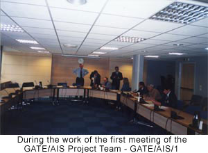
At the first meeting of the Project Team on AIS/Map (GATE/AIS/1) the following main objectives were defined and adopted:
- To assess the actual status of implementation of current ICAO provisions in the AIS/Map fields in the States of the Eastern part of the ICAO European Region, including Middle Asia;
- To identify the current and foreseen AIS/Map requirements in the States of the Eastern part of the ICAO European Region, including Middle Asia;
- To conduct a comparative analysis of the overall results, obtained from the fulfillment of the tasks listed above, and carry out necessary studies to identify the problems;
- To identify the requirements for further actions by States (sub-regional co-operation, training, additional ICAO Special Implementation Projects (SIP), transfer of know-how, etc);
- To propose the solutions to the identified problems and define priorities for their implementation;
- To analyze current situation and prepare necessary actions regarding personnel training in the field of AIS/Map in close cooperation with the Project Team on Training (GATE/TNG);
- To coordinate its work with other Project Teams of GATE, national and international bodies dealing with AIS/Map matters and so on.
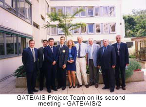
It was decided to conduct the investigations on the problems brought up in the form of a questionnaire, which was worked out and approved on the second meeting of the Project Team on AIS/Map (GATE/AIS/2) and later distributed to the ICAO States.
In the context of the co-operation with the EATMP/AIS the Eurocontrol representative Paul Bosman gave a report about the Eurocontrol work in the field of AIS/Map. The review of the Eurocontrol AIS/Map program was taken into account by the Team members and used while elaborating the future Team working program.
The work of the Project Team on AIS/Map of States of the Eastern part of the ICAO European Region begun successfully. The AIS (aeronautical information rendered) quality level and as the result the level of the civil aviation flight safety in Eastern part of the ICAO European Region states, including the Middle Asia air space will depend a lot on the results of this work.
In conclusion I would like to note that the AIS role and importance in the general aeronavigation system will increase permanently. Besides of the common nature improvements there is a certain need of the users in a wide use of the aeronautical and global data access and transmission networks. The first step in this direction was made by the elaboration and publishing the unified access to the aeronautical information and meteorological services (ICAO document EUR DOC 010) reference book by means of the pre-flight and meteorological information systems unification and rendering of the integrated information to the users.
The demands to the direct delivering of the aeronautical information from the ground data bases to the flight management system (FMS) are being developed. The general approaches have already been defined and technical requirements to the electronic representation of all aeronautical Map information which is needed for the use in the crew cockpit have been elaborated. In ICAO Annex 4 the general requirements to the aeronautical Map representation on the electronic displays are stated.
The problem of the aeronautical information spreading through the Internet and CD-ROM technologies is being handled.

THE CENTER OF AERONAUTICAL INFORMATION
OF CIVIL AVIATION OF THE RUSSIAN FEDERATION TODAY
By Elena Stepanova (CAI CA, the Russian Federation)
 |
The Center of Aeronautical Information of Civil Aviation (CAI CA) is a Federal State Unitary Enterprise of Civil Aviation within the jurisdiction of the Transport Ministry of Russia. It means that it's not a state budget organization but an enterprise that carries out it's own commercial activity on the self-financing base, as it is practice in a lot of countries of the world. At the same time it is an important organization department in the State Civil Aviation System of Russian Federation (with an appropriate organizational and supervisory functions). |
Today's the Center of Aeronautical Information is consist of 15 functional departments, including the departments of international and federal information, international NOTAM, radio navigational charts, aeronautical data base, cartography, and also the departments of development and automatic aeronautical information processing systems technical assistance, typography and the department of ready-made production dispatch.
The CAI CA functional departments employees are highly qualified pilots and navigators, who have thousands of flight hours and flight experience both on national and international airways. Having finished their work related to flights these people came to CAI CA in order to use their total experience and to continue their work on the ground, providing the flight safety to their colleges. On the whole the professional training level of the Center specialists allows to solve the problems put completely and with high quality.
 |
CAI CA publishes the AIP of the Russian Federation (four volumes, the AIP is prepared in the new ICAO format), 6 International Aeronautical Information Publications assigned to the performance of the international flights all over the world by Russian crews, and 5 Aeronautical Information Publications of the Russian Federation territory and of the CIS. |
In CAI CA the NOTAM service operates on a twenty-four hour basis. It processes, translates and dispatches about 1000 on-line telegrams per 24 hours (up to 250000 on-line telegrams every year) and 3000 printed aeronautical documents per year, which are received from foreign and national sources via electronic channels and by mail, to the established addresses. To provide this CAI CA has a dispatch office and a telegraph for the on-line connection with all the airlines, airports, aeronautical information services centers and aviation administrations aeronautical agencies from the most of countries of the world.
The library of CAI CA has and constantly updates (receives and processes up to 3 thousands of amendments every year) more than 120 AIP. On the basis of these state documents and information received from the authorized state aviation administrations there was created and is constantly updated the aeronautical data base of CAI CA. This data base is adopted for the performance of several objectives, the main from which are: regular update of aeronautical information documents published by the Center (AIP, Aeronautical Information Publications, radio navigation charts), rendering the electronic data bases to the customers that use satellite navigation systems, rendering the information for the flight planning systems, ATC, aviation simulators and so on.
The list of the Russian Federation civil aviation alternate aerodromes is one more document published in CAI CA. It contains all the information about all aerodromes suitable for take off and landing for the certain civil aviation aircraft types. The list is composed on the basis of the information, rendered by the aerodromes administration, and has a status of an official informational document which is used while planning and providing flights.
Since the year of 2001 the CIS Airways Publication in the electronic format has been issued. The information edited in the Publication corresponds to the List of the Airways of the Russian Federation, which was approved by the order of the Minister of Defence of the Russian Federation and the Minister of Transport of the Russian Federation of the 07.10.2000 ¹ 484.115, and to the following amendments to it, and also to all the aeronautical information documents of the CIS States. The Publication includes international, national and rectified airways, transit flights routes and Moscow area. The Publication indicates nationality, all the restrictions and particular features of the airways parts use or the use of the flight levels of these parts.
The CAI CA specialists own the authorship in the elaboration of a number of software products recognized within the country and abroad and which advanced greatly the work on the improvement and modernization of the aeronautical flight provision in Russia's civil aviation.
Such elaboration include the modern system SAPR-Ê, which allows to obtain a full set of radio navigational charts and terminal procedure schemes which are published in the AIP using the latest computer technologies, and also the special language CORAL, intended for supplying the on-line input of the basic data of the aeronautical procedures in the terminal area into the data base and for the autonomous check of aerodrome schemes.
The software product "Airport Optima" is intended for the air crew's and other civil aviation services' use as a reference material while holding the preflight preparation. Using this product essentially facilitates and cuts down the time of the preflight preparation for the crews, and also reduces the work of other services, that use the aeronautical information documents published by CAI CA.
Aeronautical calculator "AeroCalc" is meant to be used by the air crew and other civil aviation facilities for carrying out elementary navigation calculations. It is elaborated on the base of the calculating algorithms rendered by the Institute of Terrestrial Magnetism and Radio Waves of the Academy of Science of the Russian Federation and the Center of Geodesy and Cadastre. This product is dispatched free of charge for non-profit-making use. CAI CA understands well that the future of the aeronautical flight provision is inseparably linked with the latest computer technologies introduction and pays attention to the development of computer-aided facilities of the different air-navigation information and aeronautical Charts processing.
The CAI CA constant customers, that receive aeronautical information and aeronautical information documents from the Civil Aviation Aeronautical Information Center, are more than 230 organizations and airlines on the territory of Russia and about 150 in the CIS States. Besides, the permanent international contacts of the Civil Aviation Aeronautical Information Center covers more than 300 different state and business corporations abroad.

Publication of this bulletin is an initiative of ICAO GATE Project Team on AIS/Map in the frame of actions concerning facilitation of the level of implementation of ICAO SARPs in the States in the Eastern part of the ICAO European Region, including Middle Asia.
This AIS Bulletin is planning to issue twice per year.
Viability of the Bulletin, periodicity of its issues, urgency and usefulness of the publications, putted in it, will depend on, as far as the mutual co-operation between authors and users of the Bulletin will be fruitful, as far as the desire of each of us will be great to promote this by granting the materials for the publication on any problems concerning AIS activities.
Therefore write, call, send !!!
Editorial group:
Sergey Tkach, Head of Cartography Department of AIS, UkSATSE, Ukraine
tel.: (+38 044) 461 69 52
Fax: (+38 044) 461 69 90
E-Mail: tkach@aisukraine.net
Elena Stepanova, Director of CAI CA, the Russian Federation
tel.: (7 095) 492 31 31
Fax: (7 095) 948 59 09
E-Mail: sen@caica.ru
Simon Asatryan, Head of AIS, Republic of Armenia
tel.: (3741) 59 35 50
Fax: (3741) 28 41 42
E-Mail: ais@armats.am


